

Severe storms and flooding hit a wide stretch of the central United States in April 2026, bringing heavy rain, intense lightning, hail, tornado threats, flash flooding, and river flooding across multiple states. AP reported that from Monday to Wednesday alone, the National Weather Service received more than 1,100 severe weather reports, while governors in both Wisconsin and Michigan declared emergencies as damage and flooding continued to spread.
That is what makes this story bigger than a single storm. This was not one isolated weather event that moved through and disappeared. It was a repeated pattern of dangerous conditions stretching from central Texas through the Midwest and into the Great Lakes, with communities dealing with tornadoes, flooded roads, stranded drivers, power problems, and rising rivers over several days.
How severe the April 2026 storms were
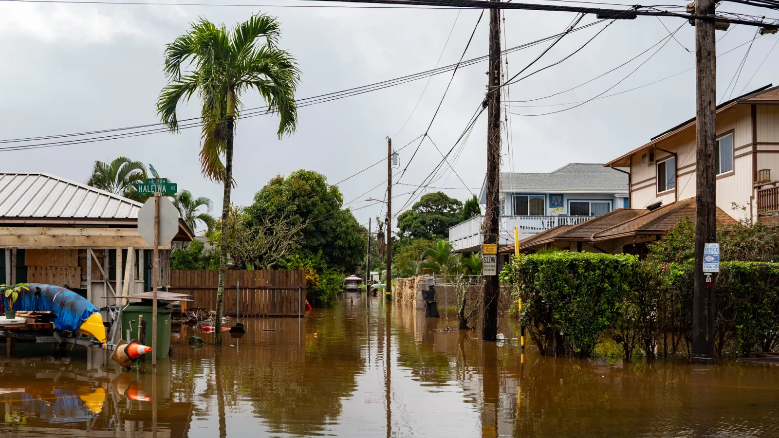
AP reported that the system produced at least one death after a man in Waukesha, Wisconsin was apparently struck by lightning. Flooding became a growing concern in several states, with emergency actions around rivers, dams, and road networks. In parts of Milwaukee, roads were flooded and drivers had to be rescued. In northern Michigan, communities dealt with flooding, utility issues, and pressure on local water systems.
The broader weather pattern also included tornadoes and damaging winds. AP reported more than 400 reports of extreme weather in one later phase of the outbreak, while official storm surveys in Wisconsin and surrounding areas continued after the storms moved through. That combination matters because homeowners were not dealing with one single threat. They were dealing with multiple types of damage at once.
Official National Weather Service summaries from the region show just how much water fell. One southeast Wisconsin review reported widespread 3 to 6 inches of rain from Monday through Friday, with the heaviest corridor reaching 6 to 10 inches in parts of the state, leading to flash flooding and river flooding along several rivers, including in the Milwaukee metro area.
Why this weather pattern became such a big problem
Meteorologists quoted by AP said the outbreak was driven by a very dynamic weather pattern that combined very moist air with a strong jet stream. That setup helped fuel repeated rounds of severe thunderstorms instead of a single short-lived event. In practical terms, it meant communities had less time to recover before the next wave of rain, wind, hail, or tornado risk arrived.
That is one reason the flooding became so disruptive. Once the ground is saturated, each additional round of rain becomes more dangerous. Water rises faster, roads close more easily, rivers respond more sharply, and smaller drainage weaknesses turn into larger community problems. The official Wisconsin storm review supports that reading by showing several days of repeated rainfall stacked on top of earlier severe weather.
This is also why spring severe weather can be so difficult for homeowners. A tornado warning gets attention quickly, but repeated rain and flood threats often create the longer recovery burden. Basement seepage, overwhelmed drainage, blocked roads, power outages, downed trees, and delayed cleanup can continue long after the most dramatic part of the storm has passed.
What changed after the storms
One clear shift was the level of emergency response. Wisconsin Governor Tony Evers declared a state of emergency as flooding and storm damage continued, while Michigan Governor Gretchen Whitmer declared emergencies in dozens of counties after widespread impacts. Those declarations reflect how broad the disruption became across the region.
At the local level, emergency measures also expanded. AP reported active efforts around dam water releases in Michigan to reduce pressure, evacuations and road closures near rising rivers, and flood responses in cities where vehicles were trapped on inundated streets. That matters because it shows how quickly a severe-weather event can grow from private property damage into a larger infrastructure and public-safety issue.
What homeowners can learn from the April 2026 storms
The biggest lesson is that storm risk should not be viewed one hazard at a time. In April 2026, homeowners across the central U.S. were dealing with tornadoes, hail, flooding, lightning, and repeated rounds of heavy rain from the same larger pattern. That means preparedness has to cover more than one scenario.
Another lesson is that flood readiness matters even when tornadoes dominate the headlines. Homes can take serious damage from water long before a river reaches a historic crest. Repeated rainfall can expose weak grading, poor drainage, sump pump failures, low-lying access roads, and vulnerable basements. That is an inference supported by the reported flooding, rescues, and emergency declarations across Wisconsin and Michigan.
It is also a reminder that warnings and response plans need to be practical. Homeowners should know how they receive alerts, what roads in their area flood first, whether nearby rivers or dams create added risk, and what they would do if power is lost during a multiday storm pattern. When weather repeats over several days, preparation becomes less about one dramatic moment and more about how well a household can handle disruption.
Why this story still matters now
This story matters because it reflects a broader reality of spring weather in the central United States. Severe storms are not always single-day events. Sometimes they arrive in clusters, with different hazards overlapping and damage building over time. The April 2026 pattern showed that clearly, from tornadoes and hail to flooded streets, emergency declarations, and river concerns.
For homeowners, that makes this a useful warning. Preparing for one storm is not enough if the larger pattern keeps producing new rounds of flooding and severe weather. The real issue is whether a property, a road network, and a household plan can hold up under repeated pressure.
How Get Climate Ready Helps
Stories like the April 2026 central U.S. storms show why climate-risk planning cannot begin after the flooding starts.
Get Climate Ready helps homeowners, buyers, and communities understand local risk patterns, compare safer areas, and look at practical steps that can reduce damage before the next round of severe weather arrives. That includes reviewing flood exposure, looking at storm-related vulnerabilities around the home, and making more informed decisions about where and how to live.
Whether you are assessing a property in a flood-prone area, planning resilience improvements, or trying to understand long-term weather risk in your region, Get Climate Ready gives you a better place to start.
Final takeaway
The April 2026 central U.S. storm pattern was not just a stretch of bad weather. It was a reminder that repeated storms can turn ordinary weak points into major losses. The lesson is simple: know your flood and storm risks, know how warnings will reach you, and prepare for more than one hazard at a time.

